I knew where I wanted to go, but I didn’t know it had a name. The Wilderness Coast is a stretch of about 100klms between Marlo and Mallacoota on the Victorian east coast. Just a hand full of small villages break the coastline, usually at the end of a detour off the Princes Highway. But, as you would expect, I laugh in the face of prudent (ha, ha haaa!) and spotted the Old Coast Road, a broken line on the map that looked like a short cut (aren’t they all?). First things first however was to pack up from my riverside location and take the five minutes into Marlo for the official start. I guess we all imagine the Snowy River as this white water serpent of the high country, but as with most rivers, it does eventually reach the sea as a wide impressive body of water. Maybe in a couple of weeks I’ll find the other end.

Marlo is pretty much a one general store , one cafe (with an impressive bait and tackle section) kinda town. I wish I enjoyed fishing more, but a lot of effort for just the one fish you’d like for dinner, and a freezer the size of two shoe boxes.
Anywho, it was a perfect summers day and first stop, Cape Conran, was only 20 minutes away. Considering how sparsely populated this area is, the smattering of beachgoers and surfers was a surprise. I guess I’m still not used to the short distances on the Victorian maps looking like the long distances on the WA maps. Clearly however, the goto beach for the locals.

The next dot on the map was just up the road, the Yeerung River. It was only curiosity and the fact that Google maps showed a loop at the end of the road, that enticed me along an only average dirt access. Coming down from the forested mountains, the Yeerung River was almost black with tannin.

A quick look and then a double back to Salmon Rocks, just south of Point Conran, and its ‘Rocks’ for a reason.

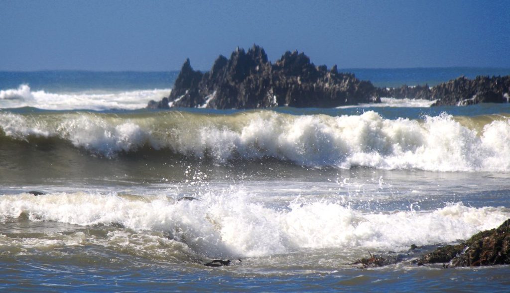
The more I wandered around the headland, the more interesting it got. It was a little window to a rugged and beautiful coast.


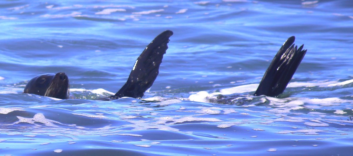
On the clamber back to the car, I spotted a couple perched at the end of a small jetty, pointing at something just a few meters away. As I got closer, something black, shiny and seemingly having a ball – a seal dining on something. Of course these moments can disappear so quickly, so a quick sprint, trying not to elbow the elderly couple into Bass Strait, to capture this special moment.

Seals always look like they’re having a good time.Even when being tossed into the air by a great white, are they screaming in terror or just going “Woohoo!!” ?

From here on, the ‘wilderness’ part kicks in. Hikers and cyclers only for the next 20klms along the Pearl Point Track, so my encounter with the Old Coast Road started a few minutes and 5klm inland. Let’s put it this way, I’ve had worse. There was just the right amount of uncertainty, the mandatory creek crossing and the 4WD got a bit of exercise from time to time. I hadn’t seen that much dust billowing in my rear view mirror since Wolf Creek. Unfortunately, there were no spectacular views from anywhere but the quintessential Australian forest was everywhere you looked.
My first exit was the road to Bemm River. Bemm River is a strange place. It reminded me of a 1950’s holiday camp, trapped in time. Apparently the fishing is famous here and all I could see was row after row of what I thought were boat trailers. Lucky to get a park at all and wandered back to a boat ramp. Dotted across the bay were not boats, but men, in floppy hats with fishing rods….. in kayaks. The national kayak fishing comp? Who knows, but not a tinny to be seen.

Back on the Old Coast Road for another leg of the big day out. There were virtually no places to pull over for lunch. Probably could have just stopped on the road and took my chances (lol). So, an hour later the Princes Hwy hove into view and barely had time to reset my bearings before Cann River loomed and a new temporary address for an anticipated heatwave.
Discover more from The Toorak Tractor and a Junko
Subscribe to get the latest posts sent to your email.